Hard to believe but the time has come for the final push. We made some changes after the NC gas panic of 2021 maybe the first of several depending on hurricane season. The main change is that we decided to have my wife take vacation for the week following Memorial Day. This gave me 8 Days as we have it planned and in a pinch up to 10 days. I had 200+ miles to go and because of that I am going to split it up into at least two different posts. The weather was looking pretty good overall. There would still be a cold front rolling through at some point early in my trip before the forecast made the change to a typical summer afternoon storm scenario. The goal is to end at Jockey's Ridge on Thursday June 3rd if all goes as planned.
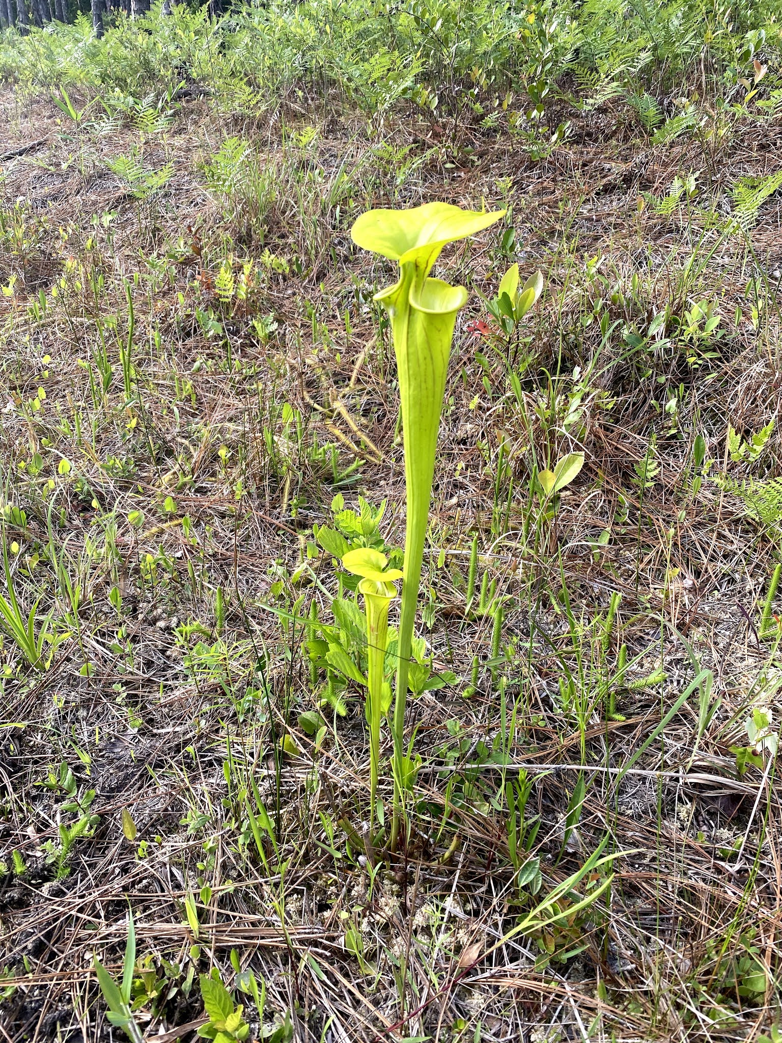
 |
| New River |
Day 42 May 28
Miles: 57.5 (47.3 Bike, 10.2 Hike)
Weather: High 90's, sunny and strong afternoon wind.
Camping: Cape Carteret Days Inn
It was a late night and long drive after my wife got off from work. We managed to leave home before 5 pm but had a 5 hour drive with three kids that needed to eat dinner, potty and be entertained during the time of day where melt downs are most likely. All that said we made the trip in pretty good shape and even though everyone woke up once at the hotel they managed to go back to sleep pretty easily. We were up early this morning and managed to leave the hotel by 7am. It was about a 20 minute drive to US 17 entrance to Stones Creek at Sneads Ferry where I left off on a weekend back at the end of April. I would start the day on my bike and travel 45+ miles before taking on some forest service roads by foot.
 |
| Stella, NC White Oak River |
 |
| Rough Green Snake |
After several miles along US 17 the trail takes backroads into Jacksonville, NC, home to Camp Lejeune. Once into town the path joins the greenway which takes you to several memorials before paralleling the military base for much of the rest of the way. You cross over the New River and then eventually end up on NC Hwy 24 a heavily travelled road much like US 17. Backroads then led me to Stella, NC. Stella is marked by a post office and a private boat launch which you can pay to use if you wish to launch out into the White Oak River. My family met me here to have a picnic lunch. It was a decision time for me as I had 3 miles to a forest service road. I could keep my bike or switch to backpacking. I really didn't know what to expect in terms of how sandy the roads might be. I decided that walking would be best so they took off after lunch to meet me just down the road where I would switch away from my bike.
All but one of the roads was in good enough shape for my bike to tackle. The road that was a little sandy would not have been terrible to push the bike along but I enjoyed the walking. I also had the benefit of being able to produce my own shade while walking with my umbrella, and it was certainly getting warmer. As I moved down one road I did pass a group of folks working to get a truck unstuck. It was incredibly stuck so I imagine it would have taken them a while. At last I made it out to Hwy 58 being Friday afternoon of Memorial day weekend there was a lot of traffic. Everyone making their way to the beach. The family after taking my bike made their way to the beach which they all enjoyed. I checked into our hotel for the evening and soon we were heading out to dinner.
Day 43 May 29
Miles: 43.8 (32 Bike, 11.8 Hike)
Weather: Highs in the upper 80's Lows in the 60-70's, Partly cloudy, windy and humid.
Camping: Dogwood Shelter, Neusiok Trail
Fifteen ticks is the number of ticks I pulled off my pants and shirt before crawling into my tent. I guess being able to search and not rush into my tent due to rain or darkness is an unforeseen benefit of arriving with plenty of daylight. I hiked some unknown amount of extra miles today as I missed the turn off along the beach. I was looking for the tree with flagging but it was back off the beach a little bit likely because the water was low. Even after backtracking and finding it I still ended up doing some searching before finding the right path. Immediately after getting out of the sand you pass by a swamp area where two red-bellied watersnakes were swimming through the water. A great welcome to the Neusiok Trail!
 |
| Neuse River |
The morning started early as I left the hotel around 6:15 on my bike. Yesterday, I walked the forest service roads and I could have ridden my bike on the majority of them so today I'm going to gamble and take the bike along. On the way to the USFS access you pass by the local speedway which was going to be hosting a race later in the day. The first FS road was gravel and easy to travel along. Intersections were well marked with MST signs so I did bother checking the map to often which was good. I eventually passed a road closed sign and there was no MST sign that I saw so kept riding. A very short while later, maybe even within view, I stopped to look at the map and see if my turn was approaching. The road closed was the turn, not knowing what type of closure and seeing that the road I was traveling along would lead me to Nine Mile Road, a paved road which the MST travels along briefly I decided to keep on my detour.
Detours can be frustrating but this one was actually pretty convenient. It didn't seem to add much in terms of mileage, was a well traveled FS road I could continue to ride my bike on and I got to see my first live black bear for the journey. I've seen many black bears in the past but it's still exciting to see one out walking about. I was downwind from the bear so it didn't smell me and never looked my direction. It briefly walked the road in the same direction I was traveling before heading off in the woods. I gave it some time to move along before starting my ride again, of course now I was making some extra noise to help keep it away.
Back on the MST off of Nine Mile Road I started walking my bike as the route was much more sand. I didn't know what it was at the time but encountered a cool creature while on this section. I saw it out in the middle of the road and it was just sitting there. I thought it was a snake, but it had colors I hadn't seen before in NC. I haven't seen all the snakes in the State but I've seen a lot. I took a photo and moved along. Later I would learn I was actually looking at a legless lizard, called the Eastern Glass Lizard. It has external ear holes and eyelids as distinguishing characteristics. By 10am I had made my way to Pine Cliff Recreation Area. My family met me here to take my bike away and shuttle it down to Oyster Point Campground where they would lock it up to a tree. I was going to start my journey on the Neusiok Trail.
 |
| Glass Lizard |
 |
| Neusiok Trail |
 |
| Copperhead Landing Shelter |
 |
| Butterfly Weed |
In addition to all the ticks (Lone Star Ticks) I picked up along the overgrown portions of trail today my snake count for the past two days is up to nine taking out what I now know to be the glass lizard. Only one of the snakes was venomous, the cottonmouth! I saw this as I went to cross one of the bridges over a swampy section of the Neusiok. It was swimming through the water under the bridge so I let it cross under and then move away a little. Once I thought it had moved far enough, several body lengths, I started crossing. It quickly alerted me to its displeasure, whipping its' head around and illustrating how it obtained its' name.
There are three shelters along the Neusiok that are in surprisingly great shape. If it was winter time I would gladly stay in these but with bugs and snakes out in full force I have packed along the lightest tent we have which is brand new three person Big Agnes tent. I'm enjoying the luxurious space and it's just over three pounds so not terrible to carry for such a short amount of hiking. I did off set the extra weight by skipping out on a sleeping bag.
Day 44 May 30
Miles: 45.5 (34.1 Bike, 11.4 Hike)
Weather: Cloudy with drizzle, Highs in the Upper 60's, Lows in the upper 50's
Camping: Lighthouse Community Church
 |
| An open area of trail! |
I knew at some point that a cold front would be moving through the area I just didn't know exactly when. It ended up passing through between 3 and 5 am bringing some big storms but nothing severe. The tent performed as expected and my sleeping system was good enough. You see, I had this heavy tent so to help offset some weight and because I really didn't expect it to get very cold I didn't bring a sleeping bag. Honestly, with the kids, I'm not as on top of weather and planning as I would have been in the past. The last report I saw earlier in the week said the temperatures would be in the 80's during the daytime and upper 60's at night. With that information I packed my wife's silk cocoon sleeping bag liner. This thing adds about 10 degrees to your bag and helps keep it clean. By itself it's like throwing a very light sheet over you providing no real warmth. That said I never got hot while sleeping so it did the job I expected. Briefly in the morning I just slipped my legs down into my backpack for some added warmth.
As the rain died down I started moving around and getting packed up around 7am. The wind had died down which was apparent as soon as I stepped out and was attacked by no see-ums. The yellow flies or deer flies were not far behind. I emptied my bug spray container which didn't do very much anyway and threw my pack on to hit the trail right around 8am. Today I had the second half of the Neusiok followed by a bike ride out towards the Cedar Island Ferry. First thing I was sent right into the hiker wash. It didn't matter that it was no longer raining I was soaked and dripping water from head to toe as this part of the Neusiok was very overgrown. I did manage to spot a Scarlet Kingsnake moving across the trail this morning. If you haven't seen one before it's a pretty cool and harmless snake with colors to scare you away.
 |
| Scarlet Kingsnake |
The flies would come and go in various parts and eventually forced me into putting on my head net. One section of the Neusiok utilizes some FS roads which I rejoiced in seeing! For at least three miles I could walk unobstructed. I had seen photos of people navigating the mud in the section after this road walk, however, it's been so dry over much of the State of NC recently that all the mud had pretty much dried. The ground was very uneven thanks to all the people who sank in the spring mud but I could just walk over the top of the now hardened ground. As I got within a mile of Oyster Point Campground I made a plan. My bike was locked to a tree and the flies were terrible so I had my bike key ready, I unlocked the bike and tossed the bike lock over my shoulder like a sling and took off riding. I stopped long enough once to the paved road to put on my helmet but simply road with my backpack on my back until I reached a convenience store about 10 miles away.
 |
| Intracoastal Waterway |
The riding today was along main NC highways but traffic was not terrible. I enjoyed multiple gas station stops with pizza, hot pockets and other great trail snacks. My family took the ferry across this morning and headed up to my brothers house in Manteo. For camping in this section there are several churches that allow hikers to simply set up in their church yard. I feel like this needs to happen along the entire trail and maybe it will catch on eventually. I stayed at the Lighthouse Community Church as it was the closest church to the ferry at 14 miles. The tick count moved up to 21. It was a cool day with lots of drizzle but I'll take that any day over 90+ degrees with 90% humidity.
I would later learn on the news of a hiker who went missing somewhere in Croatan the day I started. Through the low temps, pouring rain and then heat and humidity with no provisions he walked out into someones back yard 8 days later.


Comments
Post a Comment