MST: Black Mountain Campground to NC 181

My timing has worked out fairly well with the weather thus far on this hike, hopefully I keep that good fortune. After ending at Black Mountain Campground along the South Toe River, Hurricane Zeta made landfall in the US. Although these storms hitting the gulf coast quickly loose some strength, when they track through the Mountains of Western NC they always cause issues. We had a lot of rain and wind that resulted in the closure of the Parkway through the entire section of trail I was on last time including a small section I'll be hiking along this time. There were multiple trees down and one rock slide that needed to be cleared. If I was planning to go last weekend I would have had to change my plans. Everything has opened up just a day or two prior to my planned start and water levels are dropping rapidly so I'm sticking to my plan.
Day 13 November 6
Miles: 16.7
Weather: Sunny with highs in the upper 60's low 70's, lows in the 50's. Warm for this time of year.
Camping: Tom's Creek

Day 14 November 7
Miles: 20.2
Weather: Cloudy morning with clearing after lunch, highs 60's - 70's, lows in the 50's
Camping: Linville River

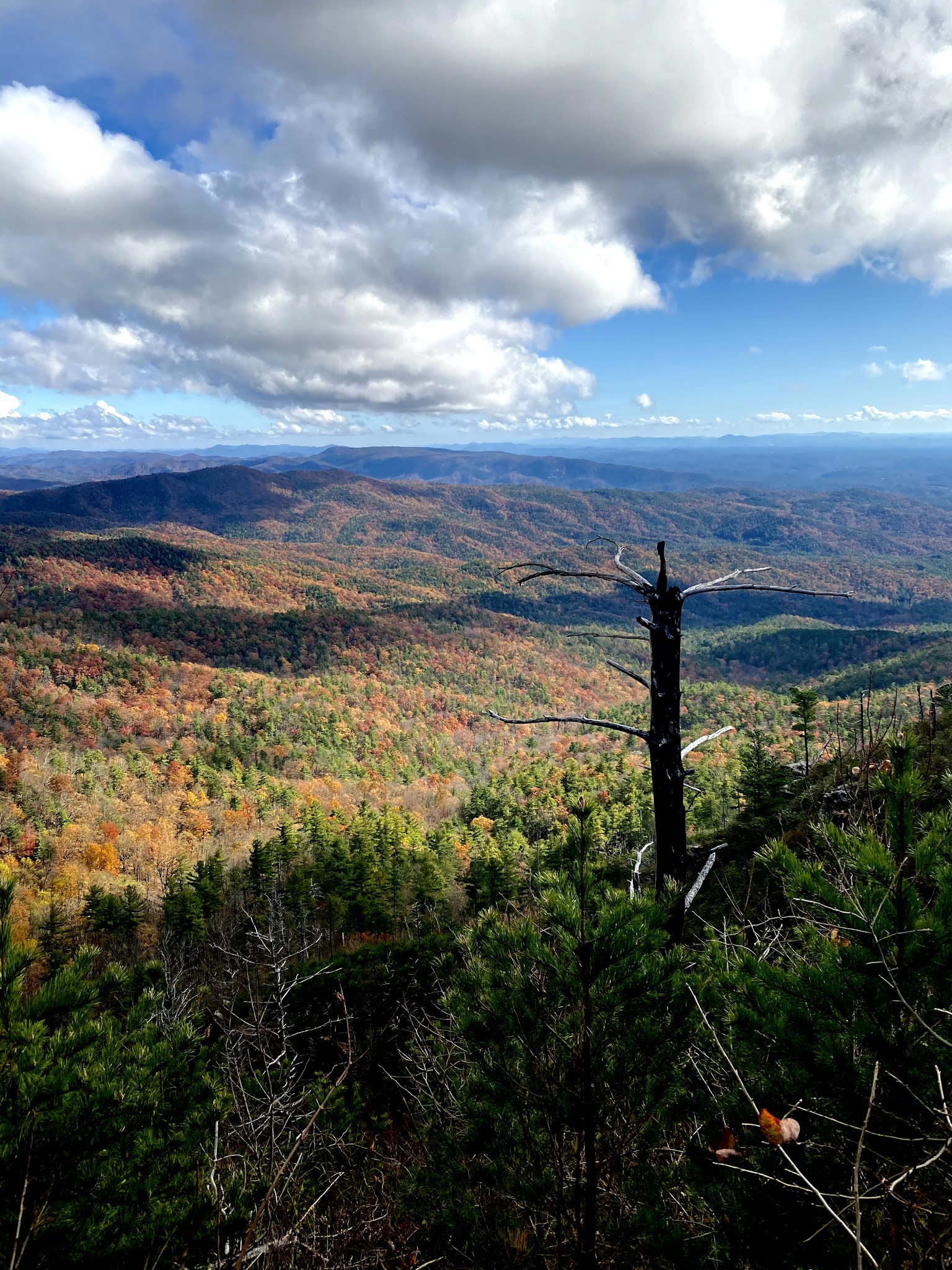
It was a big day but I think it went pretty well. We'll see how my body feels about that in the morning. I was on trail just after 6 am under headlamp. Within 30 mins I came to a trail builders joke. The trail came to a creek crossing with a plunge into a knee to waist deep pool. I walked upstream to find a shallow spot to cross. Although I couldn't get across without getting my feet wet it was certainly nice not jumping in a cold bath. Not long after I made my crossing of US 221 just outside of Marion, NC. This was by far the most dangerous part of the trail thus far. From 221 the trail meanders through some woods prior to crossing the North Fork of the Catawba River and then heads up Bald Knob. I had hiked 5 miles in the first 2 hours the next 5 miles would take me 4 hours! The trail up Bald knob takes you through a burned area meaning lots of standing dead trees and if the sun is out a really hot hike. Fortunately I had cloud cover, unfortunately, Zeta turned a lot of standing dead into trail obstacles. At one point I stopped putting my saw away and just carried it in my hand. Some were easy enough just to kick or flick out the way with a trekking pole. Once you reach the ridge there are some great lunch spots that look out to the gorge and back west. Once you move down from Dobson Knob it's several miles of road walking. By the time I made it up to Pinnacle the light provided some great views. All that was left was a steep descent into the gorge. In the middle of this descent is a small but steep ascent that provides great views of Shortoff Mountain. I knew the river was going to be deep in spots and not worth wasting time trying to stay in shallow areas. I'm glad I chose to go straight across because the water was frigid. The deepest parts were actually where you get in and where you get out. The middle of the river wasn't so deep. After the crossing I dried off and set up camp.

Day 15 November 8
Miles: 15.9
Weather: Cloudy morning with clearing, low 70's for highs.
Camping: NC 181, back home end of section.

It was a beautiful but brutal day through the gorge. In college I hiked the Linville Gorge Traverse every year but today I was walking some of that just in the opposite direction. The morning started off with a big climb up form the river, that was steep but not terrible. Cool morning air and cloudy conditions helped a lot in this area. Once I made it to the ridge and started heading to the summit of Shortoff I started passing lots of people. Most of them were still cooking breakfast and packing up camp. The hiking becomes easier for a while following the plateau along the top of the ridge. Eventually it drops and way and descends. This of course only leads to a short but steep ascent back up to the Chimneys. At this point the sun was out and although not extremely hot the heat was radiating off the ground and hitting me in the face as I walked up. The payoff is pretty grand even if you've spent a lot of time in the gorge, the views are always incredible. I stopped briefly once reaching the Table Rock parking area overflowing with people to dump some trash. I have been in the gorge a lot and for that reason I did not go up to the summit of Table Rock. Anyone doing this for the first time or who can't just drive 30 mins up the road any day you like should take the side trip. After the table rock area the trail takes you down into the Steels Creek area. The creek was loud and moving fast, luckily it was not flooding the trail. It does appear that last weekend the trail would have been underwater. I finished my last snack hiking this section and reached the car at NC 181 around 4 pm. I was tired and ready for some more food.

If I was not finishing this section at 181 I would have cut the day short and camped down by Steels Creek there are many great spots. That would leave you with a short hike to 181 in the morning if you are planning to make the hitch, coordinate with a trail angel or arrange some other type of resupply in the Jonas Ridge area. I think you could take care of resupply and then make a quick descent down the other side of 181 to a good campsite for a short resupply day.
The backpack pictured above was a Hyperlite Mountain Gear Southwest 3400 that I was borrowing from a friend to test. It certainly weighs much more than my pack but it will be time to repair mine as my sewing was not the greatest years ago. I also need to look into something that will work for taking the kids out backpacking. I think this pack will be able to handle the larger capacity and durability that will be needed moving forward.
Another big storm system has now moved through dropping a lot of rain but once again I don't believe it will have an impact on my next planned section. I will have a lot of creek crossings most I have done before so I'm not too concerned but I know for sure I will be getting wet. Here's to hoping it is not too cold!
Total weekend Miles: 52.8
Total Miles of MST Completed: 234.6
Next up: Wilson Creek Area and the High Country


Comments
Post a Comment